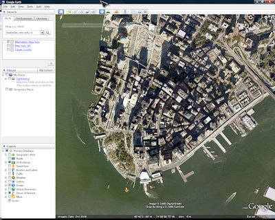
Right after start you can notice some changes. New features are briefly described in start up tips.
Key new features are:
- Oceans
- Historic images
- Mars
- Tours
Here are startup tips about new features.
This is a nice feature and one that was expected to be part of Google Earth sooner or later. After all water covers about 71% of Earth's surface. Mapping of seabed is valuable teaching tool and it provides an insight into greater picture of our planet.
Rendering of water surface is quite nice and animated. Screenshot below can't really show nice surface and moving water but you get the idea.
History view is a nice feature where availble. For example Manhattan has earlest imagery from 1974 right up to 2009. See examples below and have a lool at the top of the map area for time slider.
Some other places (like my home town of Osijek, Croatia) has imagery from 2006 onwards only. Hopefuly this will improve over time like other Google Earth coverage.
Tours can be created with full control over speed, wait at features, camera tilt and other settings. Given enough time we should see plenty of tours.
These features are also described in help (accessible on-line) over here. Google Earth can be downloaded from Google Earth main page. Coverage and review of Google Mars is coming soon.


No comments:
Post a Comment