Plenary session
I had the privilege and honor of presenting at several sessions. Most of these presentations were about CityEngine and geodesign. The first task was to prepare a 10 minute demonstration of CityEngine in geodesign for plenary session on first day of the Conference. If you are familiar with CityEngine and it's features you know it is a difficult choice on its own. Plus, I had to demonstrate the other parts of ArcGIS and their relevance for geodesign. For this very short demonstration I have decided to demonstrate the following workflow:
- Create a new subdivision in CityEngine
- Export designed options to file geodatabase
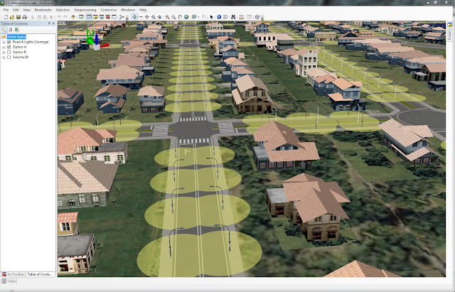
- Run analysis on new subdivision in ArcScene
- Export layers from CityEngine to WebScene
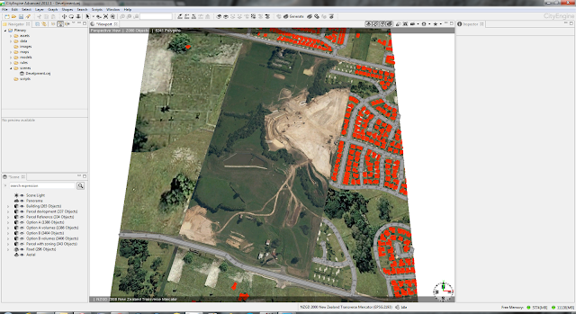
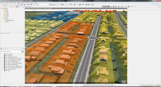
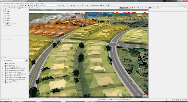
Here are some screenshots form the CityEngine project made for plenary session.
Screenshots above show two alternative designs for this subdivision. First one is a high(er) density residential with grid road pattern. To make alternative design a bit more interesting we went with radial roads and low(er) density residential option with inclusion of open/green space and trees planted on some parcels.
One of features in CityEngine 2012 is ability to visualize buildable volumes. These volumes are defined differently for different district plan zones. Screenshots below show buildable volumes for different zones in different colours.
Here are few more screenshots from the project.
Generated design options were exported to file geodatabase and used in ArcScene for analysis. Here is how data looks in ArcScene.
Lastly, the selected layers from scene in CityEngine are exported as WebScene. If you would like to have a look it is available on ArcGIS.com. You will have to use WebGL capable browser like Chrome or FireFox.
Geodesign workshop
My second engagement was conducting a half day workshop titled "Geodesign – Using ArcGIS to Improve the Design Process". In the first part of this workshop we briefly discussed the principles of geodesign. To get everyone engaged I devised an activity where each team of four carefully picked attendees had to produce first draft design of subdivision in Auckland. Design teams had a mixture of representatives from organizations like local government, consultants, utilities, conservation. They used very simple tools - coloured pencils and printed black & white map. The key here was collaboration like in every geodesign project. The second part of the workshop was all about CityEngine. We discussed basics of CityEngine and explored some possibilities for rule development in this example of subdivision.
Third task was a breakout session on "Using CityEngine 2012 for Geodesign" on Tuesday. In this session I gave a brief overview of CityEngine and discussed with the audience some options and approaches taken in example shown in screenshots above. Slides from the presentation will be available on NZ Esri Users Group web site.
All work I did for the conference would not be possible without support of several people. On of them is my colleague Bernice O'Hanlon who designed "Option A" and "Option B". Another big Thank You goes to esri Zurich staff Gert Van Maren and Matthias Buehler.


No comments:
Post a Comment