An area of land having a particular characteristic, such as sandy terrain or mountainous terrain. -GIS dictionary from ESRI
Terrain, or relief, is the third or vertical dimension of land surface. When relief is described underwater, the term bathymetry is used. Topography has recently become an additional synonym, though in many parts of the world it retains its original more general meaning of description of place. - Wikipedia
or check few more definitions from Google.
If you check ESRI's dictionary again here is the definition of the hillshade:
hillshading
- [map design]
Shadows drawn on a map to simulate the effect of the sun's rays over the varied terrain of the land.
- [map design]
The hypothetical illumination of a surface according to a specified azimuth and altitude for the sun. Hillshading creates a three-dimensional effect that provides a sense of visual relief for cartography, and a relative measure of incident light for analysis.
Penguin's Dictionary of physical geography defines hill-shading as:
A type of shading employed to create an impression of relief on a map. Most examples have the light source shining from the NW, thereby throwing the E-facing and s-facing slopes into shadow. The darker the shading the steeper the slope.
Another term used for this is relief shading. It can be defined as:
- a technique for showing the ups and downs of the land portrayed on a topographic map. The process makes land look three-dimensional by the use of ...
www.fugawi.com/web/support/glossary.htm - The use of light and dark tones to depict the form of the land; makes the map appear as if illuminated by the sun, creating highlights and shadows.
www.maps-gps-info.com/maps-gps-glossary-qr.html
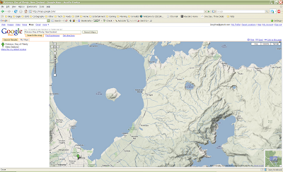
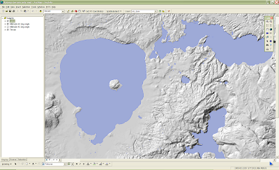
Now about the terrain in Google maps. I like an option to see the terrain but I think it could be rendered differently. It looks like folks at Google have used a higher altitude for Sun when generating terrains then GIS software defaults. I did a quick test on an area in New Zealand - Rotorua (the same area I used in older post about hypsographic shading) and got very similar result to Google's.
Here is a Google map.

This is more or less the same extent shown in the ESRI's ArcMap application with hillshade generated with 60 degrees altitude. As visible here it is very close to the one in Google Maps. In my opinion it is too light, washed out.

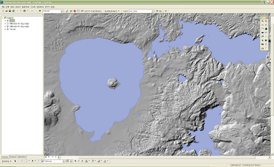
If altitude of the Sun is changed to default value in ArcMap (using Spatial Analyst extention) of 45 degrees the following is created. In here features of the terrain are much more prominent and therefore easier to visualize.

One could argue that the later is too dark or too distracting but it will always be the case beauty is in the eye of the beholder.

No comments:
Post a Comment